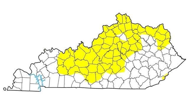
There are two counties in the southeast, Harlan and Letcher, which have small areas of “Moderate Drought,” or D1, with Harlan having 2.23% and Letcher 4.17%. Both are the same as they were last week.
Richard Heim of the National Oceanic and Atmospheric Administration (NOAA) says large parts of the Midwest region, of which they consider Kentucky to be a part of, continued dry this week.
“Continuing dry soils and the compounded effects of 6 months of below-normal precipitation and summer heat resulted in the expansion of moderate to exceptional drought in parts of the Upper Mississippi River Valley states, and abnormal dryness and drought in parts of the Ohio River Valley states.”
In addition, U.S. Department of Agriculture topsoil moisture statistics for Kentucky are short to very short across 43% of Kentucky.
Looking ahead, the Climate Prediction Center’s (CPC) 6-10 Day Outlook (September 26-30) favors below-normal precipitation centered over Colorado and extending from Missouri to the Great Lakes and New England. Odds favor near normal precipitation for Alaska. It also calls for above-normal temperatures from the Rockies to Appalachians.
The temperature and precipitation pattern favored in CPC’s 8-14 Day Outlook (Sept. 28-Oct. 4) is a continuation of conditions in the 6-10 Day Outlook.
The U.S. Drought Monitor is produced through a partnership between the National Drought Mitigation Center at the University of Nebraska-Lincoln, the U. S. Department of Agriculture, and the National Oceanic and Atmospheric Administration. Data is registered through Tuesday morning for the Thursday weekly report.


